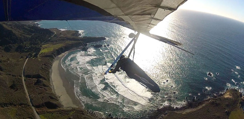
February 27th, 28th, 29th, 2016
Meet at the LZ
Let's fly on Leap Year Day!
- We will be meeting at the landing zone Saturday February 27th at 8 am
- No camping fees
- 3,000 feet to Landing Zone
- $100 per day
- Call us and sign up today
- NOTE: There is no cell coverage south of Carmel except for a small stretch in Big Sur Village (45min. N. of the LZ). This means many SmartPhones with have next to no map information). Plan accordingly.
The 'LZ' (Landing Zone) is right along Hwy. 1 on the Pacific Valley Bluff. This is 8.3 miles south of Lucia, CA and 4.7 miles north of Gorda, CA. It is located directly across from the National Forest Service Pacific Valley Ranger/Fire Station. From Monterey, CA it will take 1hr, 45min to drive south to get to the LZ.
The LZ GPS Coordinates: 35.932652,-121.468926
The primary launch we fly off is called 'Wild Cattle' which is 3,240ft above sea level and 2.85 miles from the field we land at.
To get there will requires a 45 minute drive from the landing field. The first half is paved and requires you to drive north on Hwy 1. approximately 3 miles till you reach Nacimiento-Fergusson Rd. This narrow paved road has a lot of blind turns and a cliff running alongside one side or the other of the vehicle though out the drive up..
When we reach the summit of Nacimiento-Fergusson Rd. (just before you descend the backside towards the east and down towards Fort Hunter-Leggett) we will take a right onto the 'Coast Ridge Trail' dirt road heading along the ridge line to the south-east. This second half of the drive to get to launch will require the remaining 20-25 minutes. There are a number of turn offs and branches to take with poor to no signage. This stretch of the driving is preferrably done with 4x4's with reasonable ground clearance.
The Wild Cattle Launch GPS Coordinates: 35.97148 -121.453186
NOTE: There are other launches that may be preferable due to the weather conditions to launch from so don't plan on meeting us at this launch. Instead be on time and meet us at the LZ.
